Viewing entries tagged
Celts and Druids

Alfred Watkins and Ley Lines, 20 June 1921


In New View Over Atlantis, writer John Michell gives this description of an influential inspiration that took place this day, some ninety-two years ago:
One hot summer afternoon, 20 June 1921, Alfred Watkins was at Blackwardine in Herefordshire.  On a high hilltop he stopped and looked at his map before meditating on the view below him.  Suddenly, in a flash, he saw something which no one in England had seen for perhaps thousands of years.

Watkins saw straight through the surface of the landscape to a layer deposited in some remote prehistoric age.  The barrier of time melted and, spread across the country, he saw a web of lines linking the holy places and sites of antiquity.  Mounds, old stones, crosses and old crossroads, churches placed on pre-Christian sites, legendary trees, moats and holy wells stood in exact alignments that ran over beacon hills to cairns and mountain peaks.  In one moment of transcendental perception Watkins entered a magic world of prehistoric Britain, a world whose very existence had been forgotten.  22-23.
Alfred Watkins (1855-1935) was an Englishman who delighted in traveling the countryside of his native Herefordshire, and in the country people he met and the stories they told -- stories that were often handed down for generations.  His keen eye and open mind (he was also an accomplished photographer and inventor) and his love of the countryside of his native England enabled him to perceive the network of alignments running for miles and miles and connecting ancient megalithic sites, landmarks, monuments, and natural features such as mountain peaks and high hills.  He called these lines "ley lines," or "leys," because (as Michell explains):
A peculiar feature of the old alignments is that certain names appear with remarkable frequency along their routes.  names with Red, White and Black are common; so are Cold and Cole, Dod, Merry, and Ley.  The last gave Watkins the name of the lines, which he called leys.  24.
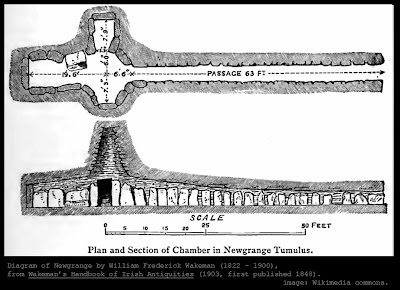
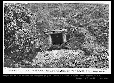
As Michell goes on to explain, "The idea of leys found little sympathy among Watkins's archaeological contemporaries.  It contradicted all their assumptions about the nature of prehistoric life" (25).  If that was true in 1921 and in 1969 (when John Michell published his first edition of View Over Atlantis), it is still true today.  The idea of leys turns on its head the conventional timeline of human history.  How could such precision and vision and engineering capability be possible to the "primitive" denizens of the British Isles in the days before Stonehenge and Avebury were even contemplated?  Note that this system must have been created before Stonehenge and all the other ancient sites in Britain were erected, since it ties such sites together with perfectly straight lines that would be impossible to design after the fact.

While these straight leys are often attributed to the engineering skills of the later Roman invaders, Michell notes that many Roman roads have been found to have much older paving stones underneath the layers of Roman construction, indicating that the Romans found the lines when they arrived and then sometimes built on top of them. Also, leys are present in Ireland, where the Romans never conquered.

Modern skeptics continue to try to write these alignments off to mere coincidence, or the human mind's tendency to find patterns in random sets of data.  For example, the Wikipedia entry on ley lines makes sure to cast frequent aspersions on the original concept and on John Michell's later examination of the phenomenon, saying: "Both versions of the theory have been criticised on the grounds that a random distribution of a sufficient number of points will inevitably create 'alignments'."  The Wikipedia entry then goes on to cite critics who say that "given the high density of historic and prehistoric sites in Britain and other parts of Europe, finding straight lines that 'connect' sites is trivial, and ascribable to coincidence. A statistical analysis of lines concluded that 'the density of archaeological sites in the British landscape is so great that a line drawn through virtually anywhere will 'clip' a number of sites." [18]"  

While these criticisms sound valid if Wikipedia is your only source of information about this concept, the interested reader is invited to read through John Michell's books (as well as the earlier books by Watkins and his contemporaries, and the many others that have been published since) and analyze the evidence for himself or herself.  The aerial photographs in Michell's books alone should be sufficient to dispel the notion that these alignments are the product of coincidence or trivial "dot-connecting" -- lines can be seen going for miles and miles and disappearing into the distance, and incorporating hilltops, gates, church steeples, and other landmarks.  

Further, as John Michell demonstrates, this phenomena is by no means isolated to the British Isles, but can be found around the world.  He provides extensive evidence from China and from North and South America to support the idea that the ancients appear to have created ley line grids around the globe.  Previous blog posts which have touched on the undeniable world-wide geodetic networks apparent in ancient monuments and sites include "Did mankind known the precise size and shape of our earth many thousands of years ago?" and "Rock Lake, Wisconsin and the Code of Carl P. Munck."

Again, this is a subject where individuals are encouraged to examine the evidence and analyze the situation for themselves.  The conclusions drawn by Alfred Watkins (and expanded upon by John Michell) have profound paradigm-shifting implications.  It is a subject too important to simply ignore, or to "outsource" to someone else to decide.  

Surely June 20th is an appropriate day on which to spend some time in consideration of the important subject of ley lines!

The Pleiades, the Upton chamber, ancient traditions and Halloween


Above is a diagram of the setting of the Pleiades over the western horizon as viewed from the Upton chamber in Massachusetts, an astronomically-aligned stone site in New England, discussed in this previous post

As shown in the map diagram that accompanies that previous post discussing the Upton site, the chamber itself is aligned to allow an observer in the chamber to look out towards the north-west, with a line of sight which proceeds out over the body of water today known as "The Mill Pond" (and to the south of the body of water known as "Pratt Pond") and up to the summit of Pratt Hill to the west, and a narrow band of sky above the crest of the ridgeline of Pratt Hill.

Also discussed in that previous post is the pioneering work done by authors and archaeoastronomers James W. Mavor, Jr. and Byron E. Dix, whose analysis of that site and many other important New England stone structures is contained in their 1989 text entitled Manitou: The Sacred Landscape of New England's Native Civilization.  

They first surmised that Pratt Hill would likely contain a corresponding mound to enable siting from the chamber -- and upon exploring Pratt Hill in the predicted location they found not one but three mounds along the horizon as seen from the Upton chamber.  These they designated A, B, and C (sometimes calling them Cairn A, Cairn B, and Cairn C).

They then examined setting positions of the summer solstice sun, as being the first thing to check based on the azimuth from the chamber to the mounds, and were rewarded with precise alignments over Cairn C, as described on pages 45-46, calculating that the rate of changes in the obliquity of earth's axis gave a probable construction date of AD 670 plus or minus 300 years.  This in itself is strong evidence arguing that this site (and the many others in the New England region that are commonly called "root cellars" and attributed to early colonial settlers) was made prior to the arrival of Europeans after Columbus.

As Mr. Mavor and Mr. Dix explain, an even more exciting discovery awaited them as they turned their attention to the significance of mounds A and B.  Here is their description:
Then came the astronomical breakthrough.  With a tentative date in hand, we looked at possible events during the same time period that could have been marked by the long mounds A and B.  Stars change their positions of rise and set due to precession of the equinoxes and proper motion by about one-half degree per century.  This can provide a very precise dating technique.  We discovered that in AD 710, Alcyone, the brightest of the Pleiades cluster of stars, grazed the top of mound A and set in the notch between mounds A and B.  Also, the match between the combined widths of mounds A and B and the width on the horizon of the Pleiades visible to the unaided eye, the eight brightest stars, is precise.  Alcyone, Electra, and Pleione set in the notch between mounds, whereas Merope set on the southern end of mound A, Atlas on the northern end of A, and Maia, Taygeta and Asterope on mound B.  46.
Above is a rough drawing of the more precise diagram found on page 47 of Manitou and showing the mounds visible on the horizon-line at the summit of Pratt Hill from the Upton chamber, with the setting of the Pleiades, which are perfectly delineated by mounds A and B.

Equally compelling, the authors note that they have "identified a total of seven large stone mounds near the summit of the hill and two about 300 yards to the north" (47).  It is very interesting that the Pleiades are known as the "Seven Sisters" the world over, describing the seven stars plus the two "parents" Atlas and Pleione (who are following at a distance from the seven), just as shown in the diagram above and also as appears to be indicated by the mounds at the summit of Pratt Hill (only three of which are visible on the horizon-line from the Upton chamber, those being mounds A, B, and C).  There are also stone rows in the vicinity of the cairns, remarkably similar to those at other important New England aligned sites (see one discussion of the possible significance of these in this previous post).

An astute observer looking at the diagram above will only count six "sisters" plus the two parents Atlas and Pleione, and this is because the seventh of the Seven Sisters is famously difficult to see with the naked eye, for reasons discussed by astronomer Steven Gibson here.  

As you can see in this previous post discussing the Pleiades and containing a diagram that can help you locate them using Perseus and other landmarks in their vicinity, the diagram above and the description in Mavor and Dix does not include Celaeno, who would have already set when Electra is in the position shown above, and who is one of the faintest of the Seven Sisters (although Asterope or Sterope is composed of two close-together stars which individually are each fainter than faint Celaeno).  This other previous post discussing the probable role of the Pleiades in the famous myth of Aphrodite and Ares being caught in a net prepared by Hephaestos also contains a diagram of the Pleiades showing Celaeno.

The reason that I am bringing up the Pleiades and the excellent work of James Mavor and Byron Dix on this particular day of the year is the fact that the Pleiades are also anciently associated with this particular night of the year, as those authors also discuss in their book (and as can be found in many other resources discussing the Pleiades in myth and ancient culture, such as the Seven Sisters of the Pleiades: Stories from Around the World, by Munya Andrews (who herself was taught about the Seven Sisters in the Dreamtime and the traditions of her people in Australia by her grandmother, as she relates in the book).

As Mavor and Dix explain:
The Pleiades have been admired and critically observed in all ages of world history, second among the heavenly bodies only to the sun and moon.  According to the historical astronomical literature, their heliacal rise and set and their midnight culmination have marked festivals, seasons, and calendars throughout the world.  The Greeks saw this group of tightly interconnected quivering stars as a flight of doves, carriers of ambrosia to the infant Zeus, and used it for orienting their temples.  The date of the midnight culmination was observed in the ancient Druids' rites of November first, and it became the traditional date of the Witches Sabbath or Black Sabbath in medieval Europe.  This tradition has come down to the modern world as Halloween, though the midnight culmination has now slipped to November 21.  52.
By "midnight culmination," Mr. Mavor and Mr. Dix refer to the transit of the stars, or the time when they reach their highest point in their arcing journey across the sky (every object in our sky appears to trace out an arc, caused of course by the turning of the earth, and the highest point in that arc is the transit point or the culmination point -- for the sun, we call this point "high noon").  In other words, the Pleiades reached their highest point at midnight at this important day at one time long in the past, but the delaying action of precession now causes that midnight culmination to take place later in the month of November.  

Even more interesting is the discussion of the quartz and water elements in the Upton site and their significance to other Pleiades-aligned sites in other parts of the world, which Mr. Mavor and Mr. Dix explain on the page following the passage just quoted:
The role of the Pleiades in the life of the Inca is known through historical records and surviving structures.  The Inca saw this cluster of stars as a universal mother who gave birth to the other stars, as well as to the new sun of the June solstice and the new year.  The earth mother, the sun and the Pleiades were also related in Inca myth by association with crystal, or quartz: a crystal fell into the water before the sun god emerged, and the rising of the sun from a spring was considered to be a birth not only from the water but also from the Pleiades.  Further, these stars were related to water in the forms of springs and rain.  All of these elements were brought together at the Coriancha Sun Temple, the most magnificent structure in Cuzco, originally sheathed in gold [note: this temple is usually called the Coricancha and spelled thus -- this is perhaps a typo by the publisher in the Mavor and Dix text].  There the rise of the Pleiades over a basin of water, also used for libations to the sun god, and the June solstice sunrise are marked by structural alignments as seen from a single observation point at the great gate.  We have already pointed out that all of these elements are likewise present at Upton, where there is a single observation point for the summer solstice sunset and the Pleiades set, and the Pleiades set sightline passes over a lake.  And quartz from the nearby quarry is frequently used in the stone row.  Thus hydrography and topography at the Upton site indicate a cosmology in which the Pleiades and water are parts, with the Pleiades representing an earth mother, observed from a stone chamber buried in the earth.  53.
As stated previously, the Pleiades are not culminating at midnight right now (although thousands of years ago they were), but rather are reaching that highest point just before three in the morning and doing so about four minutes earlier each night, on their way to a midnight culmination. The reason for the four minutes earlier each night are discussed in this previous post on Orion and precession.

At this particular moment as this post is published, the nearly full moon is almost right on top of the Pleiades, effectively drowning them out from view.  Tomorrow night (Halloween) the moon will be lower, and as it continues to wane the Pleiades will become more and more visible and easy to locate in the eastern sky after sunset (this diagram from the always-excellent night-sky diagrams at Sky & Telescope gives some visual detail).  Look above the "V"-shaped Hyades that make up the Bull of Taurus and which are diagrammed in this previous post (bright Jupiter is still in Taurus -- the opening of the top of the "V" directs you to Jupiter, making the Hyades and hence the Pleiades easy to locate once the moon moves out of the way), as well as with some step-by-step instructions guiding you to find the Hyades and the Pleiades in this previous post from this very same time of the year, one year ago. 

While many argue that the midnight culmination is the ancient origin that led to Halloween, I believe it is also important to point out that this festival marks a solar "cross-quarter day" in the annual yearly cycle, and that this significant transition towards winter is just as likely to be the impetus for Halloween.  This previous post on Beltane (a cross-quarter day in May) discusses Samhain, the cross-quarter day most closely associated with modern Halloween, and cites the arguments that some have cogently made that if summer solstice is called "Midsummer" and winter solstice is called "Midwinter," then the cross-quarter days on either side of them were probably thought of as the start and end of summer or winter (you sometimes hear people declare that summer begins on summer solstice or that winter begins on winter solstice, but the tradition of calling the solstices mid summer or winter belies that interpretation).

In any event, now is an excellent time of year to begin enjoying the beautiful spectacle of the Pleiades, and to consider their tremendous importance around the world.  It is also a good time of year to think with appreciation upon the work of James Mavor and Byron Dix in opening up new perspectives on the Pleiades with their analysis of the Upton site.


The Upton Chamber


Special thanks to the authors of the Rock Piles blog for posting a link to the recent discussion of Professor Gordon Freeman's analysis of the Sun Temple at Majorville in Alberta, Canada.

The Rock Piles site contains a host of descriptions and photographs and links to reports about the numerous stone sites of the New England region of North America. It is truly an incredible resource for those who are interested in studying or visiting these amazing places and learning more about humanity's past.

Many of these sites are completely unknown to the "academic community," which generally ignores evidence that might threaten the dominant historical paradigm, such that many sites go unprotected and largely unstudied (except by the intrepid individuals operating outside of the mainstream of academia and publishing their work in outlets such as Rock Piles).

As I wrote in this blog after a visit to the Gungywamp site in Connecticut last year:
The fact that the academic and conventional historical community stubbornly refuses to consider any explanation for these sites that includes ancient civilizations from other continents dooms these areas to obscurity and discourages their examination by large numbers of talented thinkers who might otherwise contribute some valuable perspectives to their study. Even though there are many such sites that have been photographed and written about, there are no doubt many more which are unreported by landowners who see no benefit to talking about them, but who see several disadvantages to doing so (especially when reporting their existence invites disrespectful trespassers who deface the ancient sites and leave their junk and charred firepits all over the area). It is also a sad reality that many of these ancient stone sites have no doubt been dismantled over the centuries to furnish materials to build other structures, to clear farmland or grazing land, or simply to get them out of the way.

The cavalier treatment these important sites have received from an academic and archaeological community that jeers at any explanations other than the approved solution is a true disservice to those who wish to pursue the truth.
This problem is reflected in the header of the Rock Piles title banner, which states: "This is about rock piles and stone mound sites in New England. A balance is needed between keeping them secret and making them public."

Fortunately, there are engaged individuals and groups who are taking steps to try to preserve some of these critically important locations in New England. One of these is the New England Antiquities Research Association (or NEARA), which along with the Upton Historical Commission and numerous concerned individuals recently concluded a six-year long effort to rescue and preserve the impressive stone chamber generally known as the Upton Chamber, in Upton, Massachusetts.

Less than two weeks ago, the Rock Piles blog posted a link to a report in the Boston Globe describing the successful completion of the Upton Heritage Park, now open to the public. This is an extremely important example of coordinated action for the preservation of a site that truly should be open to everyone. The story reports that the town of Upton spent $400,000 to purchase the acreage containing the stone chamber so that it would not become the site of a new housing development.

The map above shows part of the town of Upton, using the Google Maps terrain visualization feature. I've added a small black rectangle at the site of the stone chamber, which is located in the acreage west of Elm Street (and is accessed from Elm Street) looking northwest across the Mill Pond. This rectangle is actually too large to represent the actual chamber, but it's as small as I can make it.

The chamber itself is reached through a low entrance with a massive lintel stone across the top. Inside the entrance there is a long corridor (about 14 feet in length) leading to a circular "beehive" chamber about 12 feet in diameter and 12 feet high. Corbelled stone architecture was used in its construction, very similar to corbelled stone chambers in Ireland (where the chambers are often covered in earth, just as the Upton Chamber is). This article from November of last year has a good photograph of the entrance to the Upton Chamber, and this site contains a hand-drawn diagram of the plan of the chamber with a top view and side view.

This site also contains a photograph of the entrance to the Upton Chamber, as well as some discussion of the research of James W. Mavor, Jr. and the late Byron E. Dix, who spent several years examining the Upton Chamber, beginning in the 1970s. Through their efforts, they determined that its northwest-facing entrance provides a view of the horizon on Pratt Hill, about a mile away, and upon exploring Pratt Hill they located several mounds or cairns that provide precise markers for the observation of heavenly bodies from the vantage point of the chamber itself.

In their excellent and essential book on the stoneworks of the New England region entitled Manitou: The Sacred Landscape of New England's Native Civilization (1989), Mr. Mavor and Mr. Dix discuss the Upton Chamber and the Pratt Hill alignments in great detail and with numerous diagrams. They demonstrate that the cairns on Pratt Hill indicate the setting position of the summer solstice sun and for the stars of the Pleiades.

The map above shows the sightlines from the Upton chamber to the horizon created by the top of Pratt Hill to the northwest of the chamber, based on a diagram found in the Manitou book on page 39. Pratt Hill is now heavily wooded, but the authors explain that records from the nineteenth century indicate that it was not always so.

Their analysis suggests that the alignments may have been designed circa AD 700. They certainly believe that the chamber predates colonial settlers who began to arrive on these shores in the centuries after Columbus. While Mr. Mavor and Mr. Dix do not make this assertion, the celestial alignments, passage entryway, and corbelled "beehive" architecture are similar enough to structures in Ireland and elsewhere around the world to suggest the possibility that the Upton Chamber and corresponding cairns on the horizon of Pratt Hill might be the work of ancient Celts or other "Old World" seafarers (see discussion in this previous post, among others).

I had the opportunity to visit the Upton Chamber in September of last year (and to help the archaeologists and other individuals involved with the preservation efforts who were there that day to move a large stone that vandals had tumbled down in front of the entrance from one of the stone walls that emanate outward from the site of the chamber itself). Below is a picture showing the entrance as well as a picture I took from the impressive inner chamber looking outwards towards the entrance.

We should all be grateful to those involved in chronicling and especially preserving the sacred historical sites of the New England region such as the Upton Chamber, including those involved in the Rock Piles blog, the NEARA, the Upton Historical Commission, and should do whatever we can to support their efforts.


Beltane and ancient inscriptions in the New World


Above is a drawing of the "Beltane Stone" found at Mystery Hill, New Hampshire on August 31, 1975.  The drawing is modeled on a photograph in Barry Fell's 1976 classic America BC: Ancient Settlers in the New World (page 200).  That book details extensive examples of carvings and other artifacts found in the New World and evidencing usage of ancient languages and ancient writing systems known to historians of the Old World, including Phoenician, Egyptian, and Iberian (among others).

Mystery Hill, New Hampshire features a large calendar circle -- in this case a series of widely-dispersed stones which enable an observer from a central location to view the sunrise on important days of the year, which were marked by prominent upright stones (many triangular or fang-shaped) which lined up with the distant horizon.  The sun can still be observed to rise and set behind these ancient markers to this day (some of the structures at the site may also indicate important lunar stations as well).

This previous post from October 30 of last year discussed the calendar circle in some detail, in light of the approach of an important cross-quarter day, Samhain, a station of the earth's orbit that is the opposite of the cross-quarter day now arriving, known anciently as Beltane.  That post contained a diagram of the calendar circle at Mystery Hill indicating the positions of the stones and the direction to the sunrise or sunset on these important dates, which is reproduced below for convenience:


As discussed in several previous blog posts such as this one, the most well-known stations of the year are the solstices and equinoxes (two solstices and two equinoxes, for a total of four altogether), which divide the year into four sections (in other words, they "quarter" the year).   Those important stations occur near our calendar dates of March 21 (the March equinox), June 21 (the June solstice), September 22 (the September equinox), and December 21 (the December solstice).  

However, in between them there are four other dividing points, which are referred to as the "cross-quarter days," because they are in between the four "quartering" days, and indicate the point midway between each of the "quarters" created by the solstices and equinoxes.  As can be seen from the above diagram of Mystery Hill and the date markers included at that site, these cross-quarter days were also of great importance in ancient cultures.  In particular, Mystery Hill marks the cross-quarter day between the Fall or September Equinox and Winter Solstice (November 1, or Samhain) and it marks the cross-quarter day between the Spring or March Equinox and Summer Solstice (May 1, or Beltane), with rocks whose positions can be seen to this day (it also contains markers for the solstices and equinoxes themselves).

These important cross-quarter days very likely marked the beginning of winter and the beginning of summer, respectively.  As this external article on the subject aptly points out, the solstices are traditionally called Midwinter and Midsummer, which makes sense if they were considered to be the middle of winter and summer, not the beginning (we often hear today that the June solstice marks the start of summer, but it is actually Midsummer).  Thus, the cross-quarter days of Samhain and Beltane (halfway through the quarter of the year preceding Midwinter and Midsummer) would likely be the correct days to indicate the beginning of the winter and summer seasons.

Interestingly (and this has also been discussed in previous posts), the cross-quarter days may have once been reckoned on slightly different days, but migrated a few days to the beginning of their month for convenience.  For example, Martin Brennan's excellent book the Stars and the Stones identifies the cross-quarter days as falling on May 6, August 8, November 8 and May 6 (again, see discussion here).  

These dates create a more even number of days on either side of the cross-quarter days between the previous solstice or equinox and the next solstice or equinox.  This website identifies the cross-quarter days for 2012 as falling on February 4, May 5, August 7, and November 7 (dates given are for those at Greenwich Mean Time -- due to the date-line convention, some parts of the globe will be in a different calendar day when the earth crosses the exact cross-quarter point, just as with the exact passage of the earth through the precise astronomical points of each of the solstices and equinoxes).

The number of days between one solstice/equinox and the next cross-quarter day, or between one cross-quarter day and the next solstice/equinox, generally works out to around 45 or 46 days (sometimes 47 and sometimes 44, and again this will depend on what calendar date is used for the count based on the date-line convention).  

However, what is really fascinating is that the "Beltane Stone" depicted above contains an inscription in Roman numerals for the number "39" (in this case, it is rendered as "XXXVIIII").  Barry Fell believes this indicates "Day 39" -- identifying Beltane as falling 39 days after the Spring Equinox (the Spring Equinox being a traditional ancient start to the year, the day whose heliacal rising zodiac constellation named the entire Age, such as the Age of Taurus or the Age of Pisces or the future Age of Aquarius).

Fell writes that:
In 45 BC Julius Caesar instituted throughout the Roman Empire a new reformed calendar devised by the Greek astronomer Sosigenes.  The date of the spring equinox was now set at March 25, and the new year was set to start on January 1.  The Celts of New England, however, retained the old Celto-Greek New Year that began on the day of the spring equinox; in other respects they followed the revised Roman Calendar, presumably in order to facilitate business arrangements with overseas traders from Spain and Portugal.  May 1, the great Mayday festival of the Celts, called Beltane, now fell on the thirty-ninth day of the year, a fact recorded in the Romano-Celtic inscription on the stone at Mystery Hill. [. . .]  Hence the Beltane Stone dates from about the time of Christ, when the Mayday festival occurred on day 39 of the New England year.  America BC, 200.
Fell's book details many other inscriptions from the New World -- many but by no means all of them in New England -- which feature dedications to the Celtic sun god Bel, from whom Beltane takes its name (appropriate, as the day marks the arrival of the "summer quarter" of the year, one eighth before Midsummer and the other eighth after Midsummer: the portion of the year most dominated by the sun).  

Most of the inscriptions mentioning Bel are in Ogham writing, discussed in this previous blog post and in greater detail in the Mathisen Corollary book itself.  One of these, reproduced below (from page 55 of Fell's text), indicates the Ogham letters (from left-to-right in this case, although just as frequently these were written from right-to-left) "B" (the single line going down below the horizontal "stem-line"), followed by another "B" (another single carving line below the stem-line), followed by an "L" (the two lines closer to one another below the stem-line):


Barry Fell alleges that this inscription should be understood to read "B B-L," meaning "dedicated to Bel" (the Ogham inscriptions in the New World, like ancient Hebrew, did not usually include indications of the vowels, leaving that up to the reader based on context).  

Note that the letter "L" is usually just two parallel lines below the stem: in this case, the ancient engraver decided to embellish his "L" with the "quartered" design that you can see between the carved vertical lines -- it looks something like a window-pane.  Barry Fell alleges that this is a solar symbol, and indeed he produces photographs of a great many such symbols, often a quartered circle (like a Celtic Cross with four equal arms, or a circle with a "plus" symbol through it), which can clearly be seen to be associated with the sun. 

Note that this quartered circle can very easily be understood to convey the sense of the four quarters of the year, divided by the solstices and equinoxes, and indeed you can see that the earth's path around the sun can be thought of as just such a quartered circle (see the diagram in this previous post, for instance).  The inclusion of this solar symbol in the final letter of the inscription appears to be reinforcing evidence in support of Fell's translation of the inscription as a dedication to the solar deity Bel.

Fell also discusses another important inscription found on triangular stones at Mystery Hill inserted into the walls of the same chamber and containing writing on one in saying "Dedicated to Bel" in similar Ogham lines as those depicted above (without the "window pane" symbol) and "To Baal of the Canaanites, this dedication" in Iberian script and the Punic language on another (pages 90 - 91).  About this find, Fell writes: "Bel is the Celtic sun god, long suspected (but until now never proven) to be the same god as the Phoenician Baal" (90 - 91). 

Whether the existence of two inscriptions on two different tablets in the same ancient stone structure proves the direct identification of Bel with Baal is a matter for debate.  However, the existence of these inscriptions at Mystery Hill and other sites (as well as the presence of a stone inscribed with Roman numerals) appears to be compelling evidence for ancient contact from across the oceans.  Even if skeptics were to argue that the so-called "Beltane Stone" with its Roman numerals was the product of colonial settlers after Columbus, it would be difficult to argue that these later colonial-era settlers also produced the Ogham inscriptions.


Ogham inscriptions in Colorado


In 1975, historian Dr. Donald G. Rickey (1925 - 2000) was investigating the site of an 1868 battle which took place between soldiers of the 7th US Cavalry and a raiding party of Cheyenne warriors at Hackberry Springs, in Colorado.

At the time, Dr. Rickey was the Chief Historian for the Bureau of Land Management (part of the US Department of the Interior), and had a personal interest in the battle in that one of the two 7th Cavalry troopers killed in the battle was his ancestor Sam Rickey.

While at the site, Dr. Rickey discovered groove marks which he initially called "spear-sharpening marks." However, as circumstance would have it, he traveled to Scotland only a few weeks later, where he happened to visit a museum displaying the distinctive grooved writing system known as Ogham or Ogam, used by the Celts and found in throughout the British Isles, mainly in Ireland but also in England, Wales and Scotland, almost always in the form of grooves carved into stones.

He immediately suspected that the rock inscriptions he had seen in southern Colorado might be an example of this same writing system. Dr. Rickey returned to the site with other researchers over the next two years, and eventually contacted Dr. Barry Fell (1917 - 1994), a Harvard professor and the author of the controversial America BC, first published in 1976. Professor Fell agreed that the inscriptions were likely an example of Ogham, and of the older "all-consonant" variety which seems to prevail in the Americas.

Dr. Rickey submitted the site for consideration for recognition of its historic significance, but his mention of the possibility that the rock art might be Ogham elicited a swift and contemptuous response from his archaeological colleagues, as described in the short video clip above. The full text of the memos and letters between the defenders of the orthodox view of history (which does not admit to the possibility of ancient trans-oceanic travel) can be seen here.

The tone of these letters is revealing. Dr. Stuart Piggott of the University of Edinburgh (to whom the Chief Archaeologist of the National Park Service wrote upon learning of Dr. Rickey's heretical suggestion) wrote back to say "I have just heard of this and have no doubt that it is not just the fringe but hard-core lunacy. I am astonished that anyone, particularly a historian, should have fallen for it" (see page 3 of the online pdf linked above; that pdf also contains a photograph of the inscriptions on page 6).

Unfortunately, this type of refusal to consider the evidence typifies so much of the academic response to the suggestion that some of their foundational assumptions might not match the evidence.

There is extensive evidence of Ogham writing in the Americas. One excellent book detailing Ogham inscriptions in the Colorado region (and surrounding areas, where ancient waterways might have led trans-Atlantic voyagers as seen in this video) is the Colorado Ogam Album, by Donald L. Cyr (1994). That volume contains one hundred eighty high-quality photographs of such inscriptions from an area of about two hundred miles in diameter. Donald Cyr published a discussion of these important New World inscriptions in 1997 in Atlantis Rising (article here).

As this blog has pointed out many times before, the alleged Ogham inscriptions (and evidence of other Old World writing systems appearing in the New World, such as the Micmac hieroglyphs) are by no means the only "data point" which points to the conclusion that mankind's ancient history is radically different from what is being taught in universities (and defended with such smugness by professors such as the professor quoted above). For a list of other forms of evidence (with links to discussions of each), see this previous post. And that list is by no means exhaustive, either.

Sadly, the refusal of the conventional academic and archaeological community to countenance the possibility that these inscriptions might be important clues to a more accurate understanding of the ancient past acts to prevent their study and preservation, and strongly discourages large numbers of academics with expertise in Ogham from hazarding a translation of any of them, for fear that they will be branded a "hard-core lunatic" (or worse).


The Boyne River Valley, Ireland


March 17, Saint Patrick's Day, is a major holiday in the United States, due to the important contributions of immigrants from Ireland and their descendents in the history of the country, which continue to this day.

One of the world's oldest and most important megalithic sites is found in Ireland, the Boyne River Valley. The River Boyne is apparently named for the goddess Boann, whose name means "Queen" or "Goddess." Note that the celestial aspects of the goddess known as the Queen of Heaven are discussed in this previous post.

The Boyne River is home to a number of large, ancient, megalithic passage mounds, including Newgrange, Knowth, and Dowth, as well as numerous smaller mounds and cairns. Although often referred to as "passage tombs," patient work by observers operating for the most part outside of the conventional academic community (largely during the late 1960s and the entire decade of the 1970s) demonstrated conclusive evidence that the passages in these mounds were deliberately aligned to important solar events, in particular the sunrise (and sometimes also the sunset) on the winter solstice, the summer solstice, the equinoxes, and the cross-quarter days. While they may have been used as tombs later on, it is quite possible that their original function was for heavenly observation.

One of those who drove the meticulous in-person research (often in adverse weather conditions involving early pre-dawn arrivals and long treks to cold and wet sites) that demonstrated the heavenly alignments of these ancient mounds is Martin Brennan, himself an American of Irish descent, as well as an artist (his detailed discussion of the spiral art found in the Boyne River sites in his books is extremely valuable and insightful). His book The Stars and the Stones: Ancient Art and Astronomy in Ireland should be one of the first stops for any analyst of these ancient sites.

Perhaps the most well-known of the Boyne River passage mounds is the mound at Newgrange, which features a cruciform passage over eighty feet in length, aligned to the winter solstice. Newgrange also contains a sophisticated "roof-box" above the entrance -- a narrow upper window 40 inches wide and 9 inches high, framed in stone, that enables a beam of light to penetrate all the way to the back stone of the end recess in the heart of the mound on the sunrise of the winter solstice.


Newgrange also contains beautiful and complex "solar spiral" artwork carved into its stones, which Mr. Brennan shows to have had precise astronomical and solar significance (some incorporate distinctive vertical lines upon which standing stones would cast a shadow on important days).


The passage mound at Knowth contains even longer passages, oriented east and west and aligned to the sunrise and sunset on the equinoxes (one of equinoxes is coming up this week). The passage aligned to the sunrise is over a hundred feet long, and that aligned to the sunset delves into the mound for a similar distance before taking a sharp "dog-leg" and proceeding for an additional twenty-five feet.

Martin Brennan describes the alignments at Knowth:
The beam of light entering the western passage at Knowth extends much further than the beam at Newgrange. According to radiocarbon dating Knowth was built about 500 years before Newgrange. The eastern passage, which cannot be observed because of obstructions, is about twice the size of the Newgrange passage. In the western passage the light beam extends nearly to the sillstone, beyond which the passage veers to the right. [. . .] Because of their length and the time of year they indicate, the passages at Knowth are unsurpassed for their astronomical potential in accurately defining a particular day. The full extension of the light beam entering Knowth West can be observed from the back recess of the passage. From there the appearance of the light beam would indicate equinox. Some archaeologists believe that this area of the passage once formed part of an earlier and smaller mound, although at present there is little evidence to support the idea. In any case, as it stands today, as a solar construct, the passage represents one of the great wonders of the Neolithic world. Stars and the Stones, 107.
As Mr. Brennan explains elsewhere in his book, a passage mound in which a precisely narrowed sunbeam strikes a rock deep within an interior chamber provides a much more accurate indication of an important solar station of the year than a gnomon or menhir casting a shadow.

Conventional historians admit that the mounds of the Boyne River Valley complex were probably constructed as early as 3200 BC. This means that they have stood for an astonishing 5,200 years or more, as of this writing.

When one considers the precision of the alignments of the roof-box at Newgrange and the hundred-plus-foot passages at Knowth, as well as the vertical lines in the carvings which align on significant dates with shadows cast by mighty stones (some of which have fallen over or been moved, but whose intended positions can be determined by surviving sockets), it seems amazing that no one has realized what a damaging blow this site deals to the accepted tenets of tectonic theory and "continental drift." Previous posts, such as this one and this one, have discussed this concept in conjunction with other ancient megalithic sites that retain their heavenly alignments as well (sites located at many points around the world, and not just on one continent).

The Mathisen Corollary book also discusses this telling evidence, how it calls the tectonic theory into question, and how the alternative theory proposed by Dr. Walt Brown -- the hydroplate theory -- not only clears up this geological mystery and many others, but sheds important light on other aspects of ancient civilization and mankind's ancient history.

The Mathisen Corollary book also examines evidence which suggests that the stone structures found in many parts of New England, while not as massive or magnificent as the largest mounds found in the Boyne River Valley, may be related to those of the Old World, and may have been built by members of the same culture, or by descendents of a culture that was influenced by those responsible for the megalithic structures of ancient Ireland.

This possibility, of course, is another that conventional academia refuses to accept. However, just as conventional academia for a century refused to accept the possibility that the passage mounds of the Boyne River Valley might represent sophisticated heavenly observatories, and just as they were eventually forced to grudgingly acknowledge the evidence that heavenly alignments were carefully built into these most ancient of structures, the evidence for ancient contact between the continents is extensive and will eventually be impossible to ignore or suppress.

Perhaps, it will then be possible to say that "immigrants" from the Emerald Isle played a significant role in the history of North America thousands of years earlier than most people suspect!

Important cross-quarter day approaching!


We're approaching another "cross-quarter day" in the earth's annual orbit around the sun. It is, in fact, the most famous of the cross-quarter days for modern cultures, due to the tradition of Halloween, which is the most famous and most actively-celebrated surviving remnant of the cross-quarter day festivals that took place to mark these important stations of the year in many ancient cultures.

We've examined the concept of cross-quarter days in previous posts such as this one. To shed some more light on the subject, and the upcoming day in particular, let's take a look at the paths of the sun through the sky as marked out by the unknown builders of the observatory at Mystery Hill, New Hampshire (in the United States).

The diagram above shows that the builders of this observatory placed stone markers at points aligning with the rising and setting of the sun on certain important days of the year, including the two solstices (the summer solstice being the point of northernmost rising and setting, and the winter solstice the point of southernmost rising and setting of the sun along the eastern and western horizons each year) and the equinox (a point between these northernmost and southernmost points, where the sun will rise and set on the two equinoxes as it passes through on its way north to the summer solstice and south the the winter solstice points each year).

As explained in the previous post discussing Mystery Hill (linked above), this site was first reported in 1826, but it was not until the 1960s that astute observers began to suspect that it contained astronomical alignments, and not until the beginning of the 1970s that they began to be demonstrated conclusively.

The diagram above is laid out such that north is upwards (and indicated by a north-seeking arrow, which the ancient builders also marked with a series of fang-shaped stones drawn in the top of the diagram, the central "tooth" being the largest and indicating north, the the auxiliary stones to either side thought to represent markers indicating the direction of Thuban, a star in Draco which was located near the celestial south pole millenia ago). East in the diagram is therefore to the right, and west to the left, and south is indicated by a stone wall drawn in the diagram which is constructed of a long thickened "wall" of stones oriented due north-south in the observatory itself.

Of course, the earth turns towards the east, meaning that the diagram above moves towards the right during the course of the earth's rotation, causing celestial objects (including the sun) to trace out pathways from right to left in the diagram -- from the east to the west. The sun will thus rise on the eastern horizon (beyond the diagram) on the right, and will do so at its northernmost point on the day of summer solstice. The rising point on that day each year is indicated by a large triangular standing stone indicated on the diagram.

During the day, as the earth turns, the sun will trace out an arc in the sky, always remaining between the observer and the southern horizon at this latitude (this fact can be understood from the next diagram below), and will then set on the western horizon at its northernmost point, marked by another impressive standing stone which is indicated on the diagram above as well.

The sun reached the summer solstice -- or, more properly, the earth reached the point in its orbit that creates the summer solstice conditions -- back in June of this year (on the 21st), discussed in this previous blog post. As earth continued on its annual track, the sun's rising point progressed southward, moving towards the fall equinox and onward towards the winter solstice.

The reason the sun's rising and setting points move along the horizon is discussed in greater detail in the Mathisen Corollary book. A brief diagram, shown below, should give some explanation. It shows the earth tilted on its axis, going around the sun on a plane that is viewed "edge-on" so that it looks like a flat horizontal line. An observer on the earth is drawn in the northern hemisphere, and as the earth rotates he will see the sun only as earth's turning brings him around to face it each day (so "day" is when facing to the right for the observer on the "left earth" at winter solstice and "day" is when facing to the left for the observer on the "right earth" at summer solstice). The angle of the sun as it arcs through the sky will be very different for the observer on the earth at right (summer solstice) than at left (winter solstice), and its rising and setting points will be as well.


Between the solstices and the equinoxes (which divide the year into four portions and were thus also known as the "quarter days"), ancient cultures also tracked intermediate stations known as the "cross-quarter days," which fall on the approximate calendar dates of August 8 (after Summer Solstice on the way towards the September Equinox, halfway between the two), November 8 (after September Equinox, halfway to the Winter Solstice), February 4 (after the Winter Solstice, on the way towards the Spring Equinox and halfway between those two stations), and May 6 (halfway between the Spring Equinox and the Summer Solstice).

These dates are taken from Martin Brennan's essential book, The Stars and the Stones (page 39), discussed in this previous post. Of course, just like the solstices and equinoxes, the actual calendar dates drift slightly from year to year, as the calendar gets slightly out of line with the orbiting earth and then is brought back again by the insertion of a day during the leap year).

In addition, the ceremonies and festivals associated with the cross-quarter days have generally been moved to the first of the month in Europe, so that they are now most closely associated with traditions centered around the first of August, the first of November, the first of February, and the first of May, or the day following (such as in the case of Ground Hog Day) or the night immediately before (such as Halloween).

The Celtic festivals and ceremonies associated with the cross-quarter days are Lughnasad (the early August cross-quarter day), Samhain (the early November cross-quarter day), Imbolc (the early February cross-quarter day), and Beltane (the early May cross-quarter day). These names all have various spellings and variations.

The Catholic church incorporated the cross-quarter days as Lammas (August 1), All Saint's or All Hallow's Day (November 1), and Candlemas (February 1).

The cross-quarter days were also associated with the start of the seasons of summer and winter, which is why the solstice dates were known as Midsummer and Midwinter. This website discussing the cross-quarter days aptly points out that if summer didn't start until Summer Solstice (June 21 or 22), then it would make no sense to call the summer solstice Midsummer.

That site also notes the parallels between the cross-quarter days of November and May, in that the night before each one was associated with the thinning of the barrier between the world of the living and the dead, such that both October 31st and April 30th were thought to be nights of witches and spirits. The two cross-quarters are connected in that the October-November cross-quarter marks the beginning of the darkest segment of the year (in the northern hemisphere), containing at its mid-point the winter solstice, and the April-May cross-quarter marks the beginning of the brightest segment of the year (in the northern hemisphere), containing at its mid-point the summer solstice.

Because these cross-quarter days were very important to the ancient Celts and Druids, the presence of observatories in the New World with clear markers for both the quarter days and the cross-quarter days is noteworthy. It is, of course, possible that these stone observatories are the creations of native peoples of North America, and that their marking of the cross-quarter days arose in isolation of the attention paid to the cross-quarter days in other cultures in other parts of the world.

However, this is not the only possibility, nor is it necessarily the most likely possibility, in light of other evidence of ancient trans-oceanic contact that is rarely mentioned by conventional histories (see for example the discussions here and here). It is very possible that sites such as Mystery Hill, New Hampshire were created by Celtic visitors or settlers in the New World thousands of years ago, or perhaps that the builders were influenced by relatively brief contact with ancient Celtic travelers. Since it is also possible that the Celtic culture was influenced by another ancient culture, it is also possible that another ancient culture other than a Celtic culture built or influenced the building of the sites in North America which preserve markers of the quarter days and cross-quarter days.

In any case, it is worth taking the time to understand the celestial mechanics that create the quarter days and the cross-quarter days, and how the stone observatories preserve these heavenly activities with markers on the ground. If you have access to a suitable piece of ground, you could designate a central observation point and then mark the sunrise and sunset points on the quarter and cross-quarter days for yourself. Since a significant cross-quarter day is about to arrive, this is an excellent time to start just such an observatory, if you are so inclined!